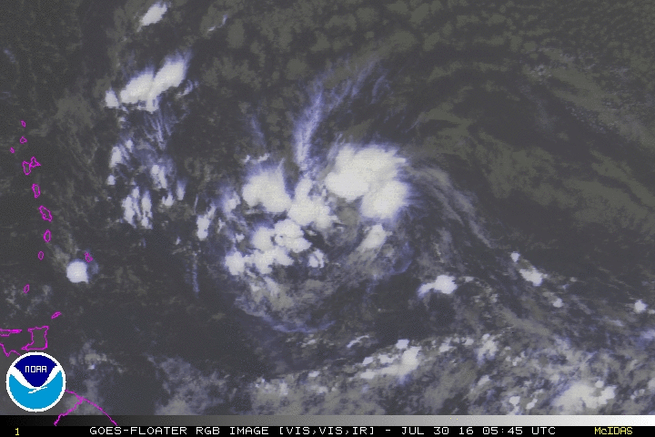
Good morning everyone! Well, if you are in the Lesser Antilles or Puerto Rico, then you are likely watching Invest 97L. The main impact for the region will be the squally conditions over the weekend. As we look at this morning's satellite loop, you can see that 97L has increased its storm coverage. However, wind shear should keep it in check as it barrels through the eastern Caribbean. Once it reaches the western Caribbean, environmental conditions look more conducive for tropical development.
There are several different model solutions for the evolution and track of 97L. Some models take into Central America, while others take it into the Gulf of Mexico/Bay of Campeche. Right now, it is hard to forecast the track of this system because we don't know how this storm will exactly evolve, model uncertainty, and the amount of time that this system has before it reaches the western Caribbean. Here are just some of the model solutions:
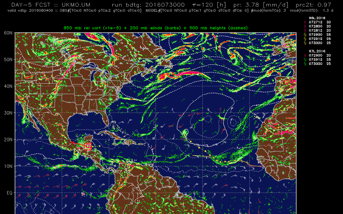
UKMET
FIM9
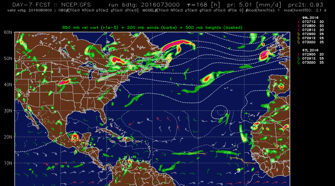
GFS
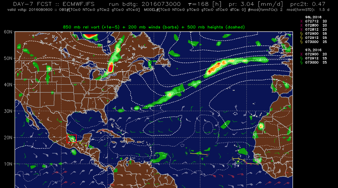
ECMWF
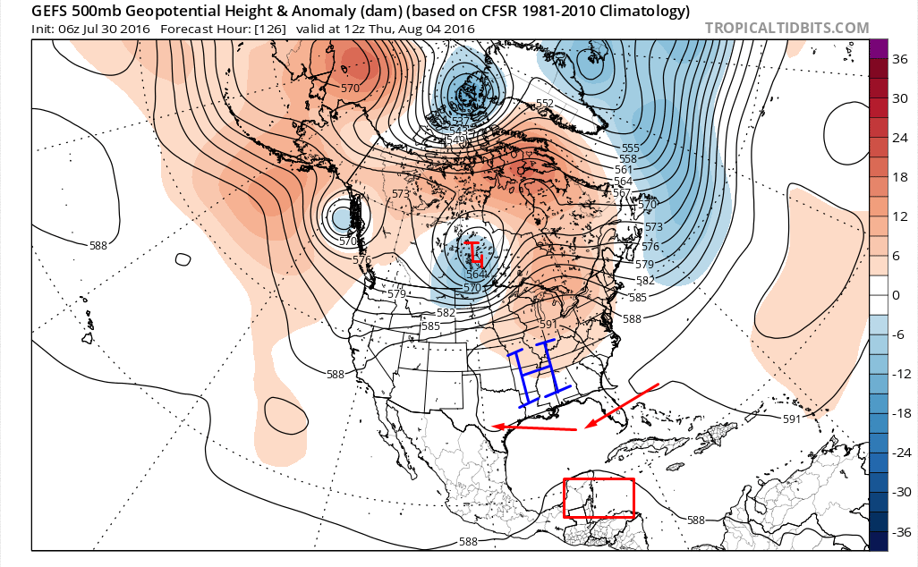
One of the things that will definitely determine 97L's track will be the HP in the Central U.S. Also, *if* 97L rapidly deepened in the western Caribbean, then it would likely be pulled northward into the GOM. However, if it stays weak through the western Caribbean, then it would likely be driven into the Yucatan by the anticyclonic flow of the HPS. There are still a lot of variables at play, but if you want lots of updates on the tropics, then definitely follow my Twitter page (@Wx_Geek).